POPULATION FIGURES
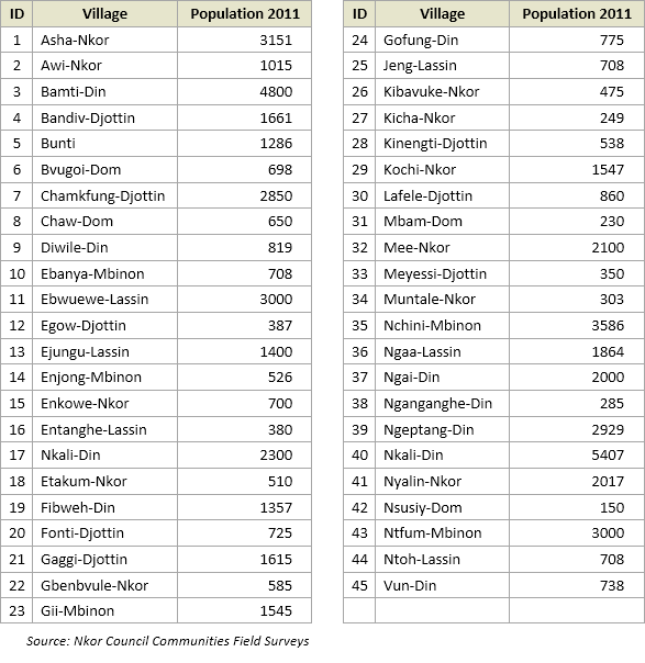
The estimated surface area of Nkor Council is 325.7 Sq.km. The population of this Council area in 1987 stood at about 17,700 inhabitants. During the surveys the population obtained from all the communities summed up to approximately 63487 inhabitants see the Table below. This population is predominantly of the Noni ethnic group, sparsely settled across the Council area under ten (10) traditional Fondoms, with six (6) principal concentration zones along the Noni Ring Road at Mbinon, Lassin, Nkor, Dom, Din and Djottin.
In addition to the indigenous Noni population, there is a growing trend for settler populations in the Council Area: a significant Fulani population, grouped into some eight (8) ardorates, is scattered across the entire council area, while a small colony of Nso extraction migrated from the neighbouring Kumbo subdivision and settled in Dom around Banten and Fofueng, and in some areas of Djottin around Buh, Mbiim, and Kerri (commonly referred to as Djottin-Nso).
Population figures of the communities 2011